Construction Data. Aerial Perspective.

CapMaps provides construction-focused surveying and mapping, progress documentation, and professional aerial media from active sites through final completion.

CAPMAPS SERVICES

Choose the View Your Project Needs

CapMaps combines construction-focused surveying and mapping with professional aerial media, giving project teams accurate site information and a better way to showcase their work.

CAPMAPS SITE DATA

Surveying & Mapping

Accurate aerial data built for construction.

CapMaps combines RTK-enabled drone capture, ground control, professional photogrammetry, and real construction experience to provide clear site information your team can review, measure, and use.

Existing-Condition Mapping

High-resolution aerial mapping and orthomosaic imagery for planning, coordination, documentation, and site review.

Earthwork & Volumes

Stockpile measurements, cut/fill analysis, and quantity-focused reporting that help teams understand site progress.

Progress Documentation

Repeatable aerial captures that document changing site conditions, support reporting, and create a clear visual project record.
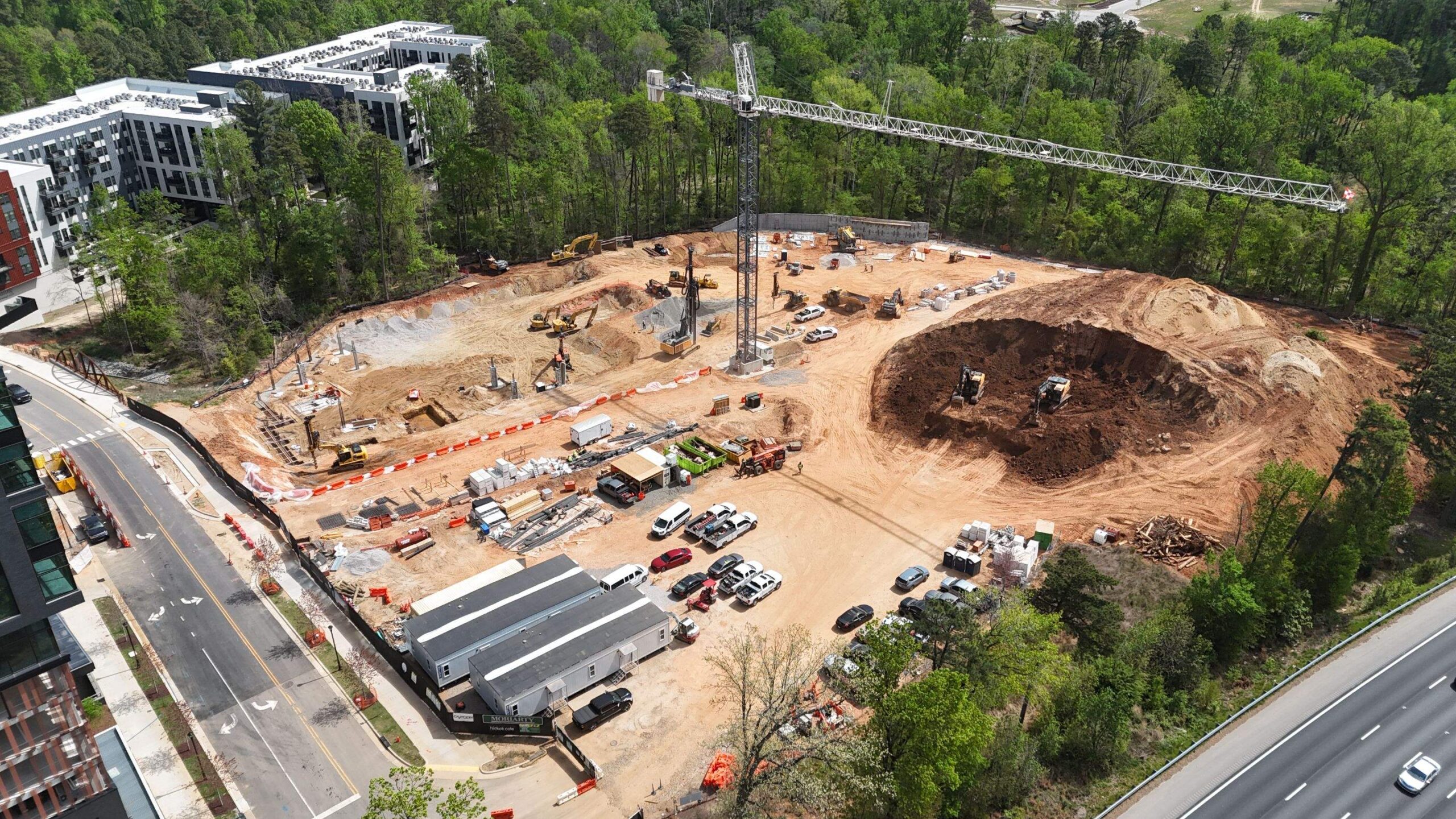
Aerial view of an active CapCon construction site
A complete site view gives teams a clearer understanding of existing conditions, active work areas, and overall progress.
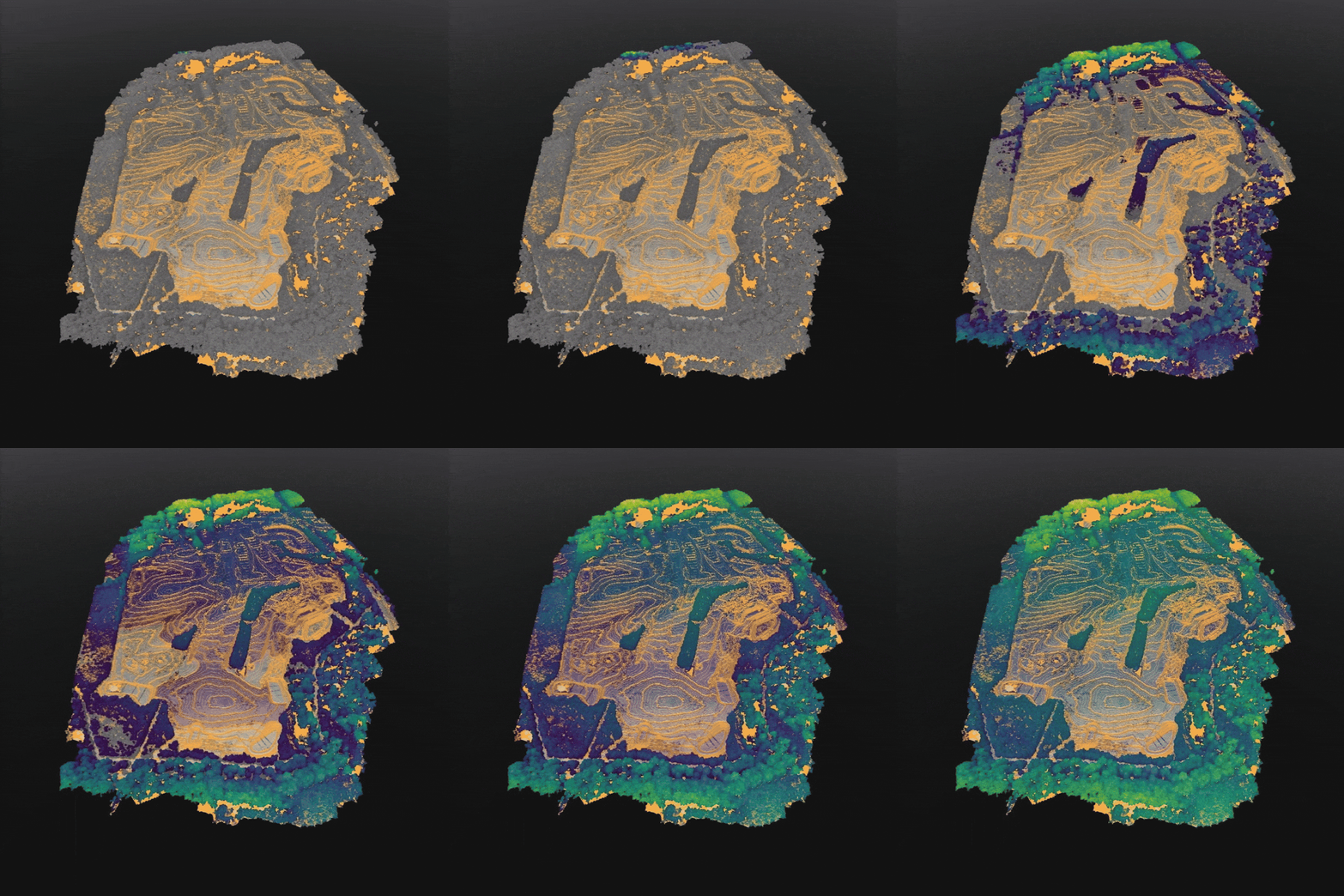
Processed aerial site mapping model
Processed site data for visualization, coordination, and measurement.
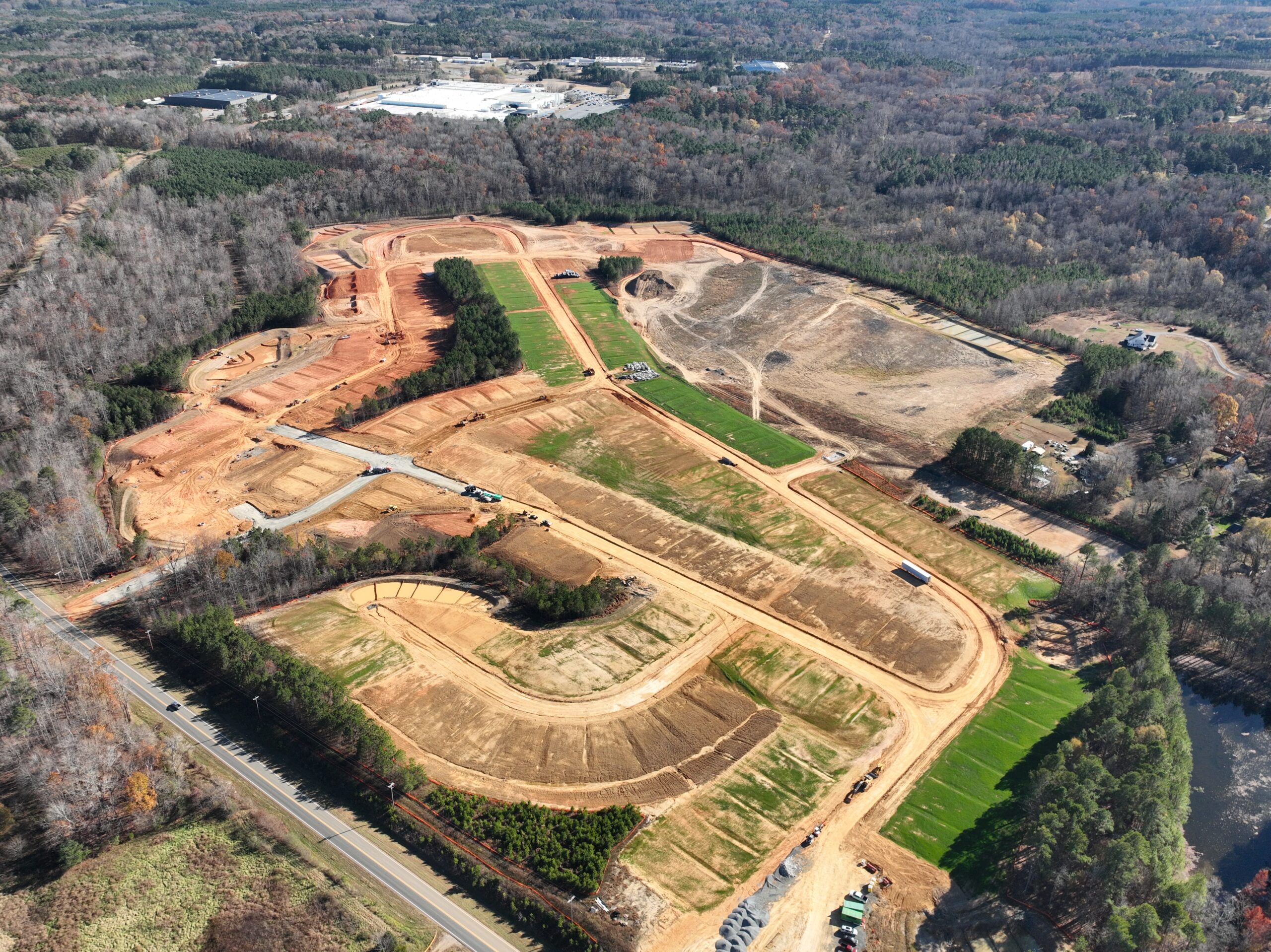
Aerial construction progress documentation
Clear progress documentation for active construction sites.
WHAT YOU RECEIVE

Construction-Ready Deliverables

Deliverables are selected around your project goals, software, reporting needs, and level of analysis.

01

Orthomosaic Maps

High-resolution, georeferenced aerial maps for review, documentation, and coordination.

02

Topographic Surfaces & Contours

Detailed terrain surfaces and contour information for planning, estimating, and analysis.

03

3D Models

Surface models, point clouds, and visual site references for project teams.

04

Volume Reports

Stockpile, cut/fill, and earthwork quantity reports when required.

05

Progress Documentation

Organized aerial imagery showing site conditions and progress over time.

06

CAD-Ready Exports

Available file types may include TIFF, LAS, DXF, OBJ, PDF, and other project-compatible formats.

BUILT FOR CONSTRUCTION

Accurate Data. Practical Results.

CapMaps is backed by Capital Construction Company’s real field experience, so each mission is planned around active jobsite conditions and the information construction teams actually need.

RTK & Ground Control

RTK-enabled capture and ground-control validation support consistent, repeatable results.

High-Resolution Outputs

Detailed imagery, maps, surfaces, and models built for clear project review.

Compatible Deliverables

Files can be prepared for AGTEK, AutoCAD, Civil 3D, engineers, surveyors, estimators, and internal teams.

FAA Certified & Insured

Missions are planned and completed under FAA Part 107 and CapCon jobsite safety procedures.

HOW IT WORKS

A Clear Four-Step Process

01

Plan

We review your project goals, site conditions, plans, access, airspace, and scheduling needs.

02

Capture

A repeatable flight plan collects aerial data safely and efficiently around active operations.

03

Process

Captured data is processed into maps, models, surfaces, reports, and project-ready exports.

04

Deliver

Your team receives organized files or secure links for review, measurement, coordination, and reporting.

YOUR NEXT PROJECT

See How CapMaps Can Support Your Site

Tell us what you need to map, measure, document, or monitor, and we will help determine the right approach.

Contact CapMaps

CapMaps provides aerial mapping, documentation, measurement, and photogrammetry services. Boundary, legal, and other licensed land-survey services must be performed or certified by an appropriately licensed professional when required.

CAPMAPS PROJECT STORYTELLING

Aerial Media

Show your project from a better point of view.

CapMaps creates professional aerial photography and video for builders, developers, contractors, and project teams. From routine progress updates to polished project showcases, every flight is planned around your site and the story you want to tell.

Progress Photography

Clear aerial photos that document active construction, changing site conditions, major milestones, and completed phases.

Aerial Video

Stabilized aerial footage for websites, presentations, social media, owner updates, recruiting, and project marketing.

Marketing Content

Project visuals designed to help your team highlight progress, promote communities, and share work with clients and partners.

FPV Flythroughs

Dynamic low-altitude footage that moves through sites, structures, equipment areas, and completed spaces.

Final Project Showcases

Finished photos and video that present the full project, completed work, amenities, infrastructure, and overall site.

FLIGHT PACKAGES

Choose the Coverage That Fits Your Project

Base packages include professional aerial capture, light color and exposure cleanup, and organized digital delivery.

Best Starter

RDU Flight

Starting at $295 per visit

Best for Raleigh-Durham projects, quick progress updates, and one-time marketing captures.

  • Up to 1 hour on site
  • 15 to 35 aerial photos
  • 6 to 10 stabilized aerial clips
  • Organized digital delivery
  • Standard commercial usage

Travel included within the standard RDU service area.

Extended Coverage

Regional Flight

Starting at $450 per visit

Best for projects outside the core service area, longer travel, or additional capture time on site.

  • Up to 2 hours on site
  • 35 to 65 aerial photos
  • 8 to 12 stabilized aerial clips
  • Organized digital delivery
  • Standard commercial usage

Final pricing depends on travel distance and scheduling.

What’s Included

  • Drone capture of entrances, streetscapes, amenities, homesites, active work areas, and completed phases
  • Light exposure and color correction for clean delivery
  • Organized media folders for easy internal use
  • Standard delivery within 3 to 5 business days
  • Commercial usage for websites, email, presentations, and social media

Optional Add-Ons

  • Edited social media reels with music
  • Branded project highlight videos
  • Logo, title, and basic motion graphics
  • FPV interior or jobsite flythroughs
  • Rush turnaround within 48 hours: +$200
  • Extended travel or special scheduling
PROJECT STORYTELLING

See CapMaps in Action

Real jobsite footage can be combined with equipment, people, motion, music, and branding to create a polished project story.

CapCon Brand Highlight Video

A project video using real jobsite footage to highlight equipment, movement, people, and progress in the field.

YOUR PROJECT. YOUR STORY.

Bring Your Project’s Story to Life

Tell us what you want to document, promote, or showcase, and we will help build the right aerial media package.

Contact CapMaps

Final pricing may vary based on travel, airspace restrictions, scheduling, site access, requested deliverables, and total locations.

a better view with capmaps

TOP